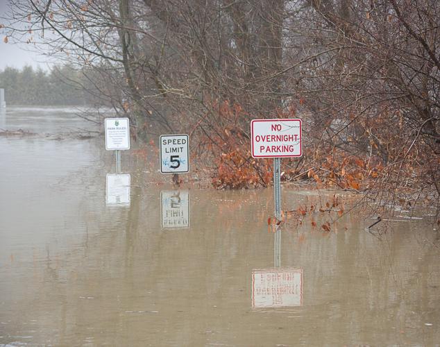
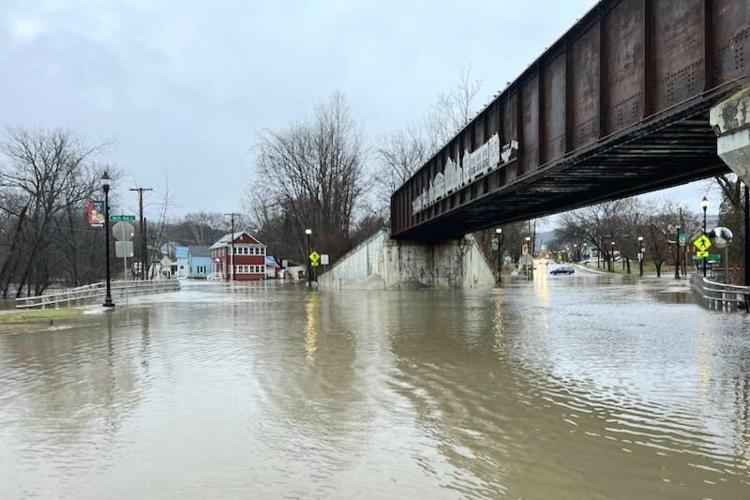
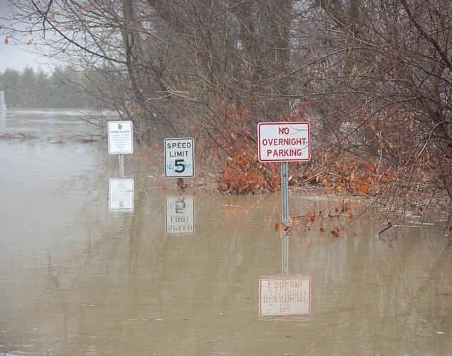
BARRE — Almost six months since the last major weather event in Vermont, heavy rains, high winds and warmer temperatures led to serious flooding around sections of central Vermont and the Mad River Valley.
As of 5 p.m., rivers had crested in Barre City and around Waterbury. Water levels in the Capital City continued to rise as rain kept falling through the afternoon.
As Gov. Phil Scott was preparing to brief Vermonters on the flooding, Montpelier City Manager Bill Fraser reported that city was “about to hit flood stage.” Fraser said he was hoping forecasts would hold and the flooding would continued to be “moderate” and not turn catastrophic like it did in July.
Elsewhere in the region, though, the flooding was taking its toll.
Scores of roads were closed due to floodwaters, as well as sections of state roads: Route 2, Route 12 and Route 100, among them. At the time of this reporting, more roads were being closed by local crews, and rescue teams were having to help stranded motorists around the region.
Utility crews in central Vermont – both Washington Electric Co-op and Green Mountain Power – were responding to various outages caused by downed trees and limbs on power lines. Several thousand households were affected throughout the day on Monday.
In the Twin Cities, which is still in active recovery mode from the July floods, local officials spent much of the day paying close attention to the rising floodwaters, exacerbated by the snow melt. Sandbags were brought in and proved to be necessary.
The river through Barre was at 5.5 feet at 9 a.m., and was sitting at six feet when it was checked in the afternoon. City officials said there wasn’t “serious concern” about the downtown, though there was concern for the previously flood-ravaged north end.
Barre City Manager Nicolas Storellicastro sounded anxious at 4 p.m. At that time, the river gauge on Burnham Street was no longer visible. He said it is “beyond puddling” on Depot Square, where the water was up to the sidewalk shortly before 4 p.m. and there was some flooding on a problem area of the river on West Second Street.
A Barre City dispatcher announced at 4 p.m. that water had crested the river at Park Street. Emergency crews began shutting down roadways in the downtown area.
“We’re down to hopes and prayers at this point and that’s not the mitigation strategy you want,” Storellicastro said, noting flood mitigation initiatives the city has taken had been working.
“We need a break in the rain,” he said.
At 5 p.m., it was still raining hard.
The American Red Cross had been activated by the state to open the shelter at the Barre Auditorium. It was scheduled to open to the public Monday afternoon. Emergency crews and volunteers were helping to relocate individuals.
“This is a Red Cross managed site operating in coordination with Barre City officials. The Red Cross is also working closely with local and state emergency management and government officials. We remind Vermonters to heed all transportation warnings and obey road closures. Do not drive through flooded roadways,” the Red Cross said in a statement.
Early in the day, Tracie Lewis, director of the Barre Partnership, sent out an email stating in part, “Barre City staff is actively monitoring known flood hazard areas. Please remain vigilant. … Out of precaution, please get things off the basement floors.” That proved to be sound advice.
The Capital City on Monday also was preparing for potential flooding around the downtown.
According to a news release issued by Montpelier’s Fraser, “The City of Montpelier is actively out monitoring the rivers and flood conditions in the City.” State Street near Bailey Avenue was closed off due to flooding, and some business were reporting water coming into their basements at 4 p.m.
Fraser said the National Weather Service had upgraded Montpelier’s flood risk “significantly” in the late morning. “They now predict a Winooski peak of 16.8 feet which is above the 15-foot flood level. The prior projection had been 9.7. The July flood was around 20 feet,” he wrote, urging residents and business owners to keep tabs on the potential threat until floodwaters had subsided. At 2:45 p.m., the level was at 13.96 feet.
Fraser said city staff closed the 60 State St. parking lot. The Department of Public Works and Montpelier Police Department were seeking to have vehicles relocated to higher ground. Folks were urged not to drive in the flooded areas.
Both Barre and Montpelier officials urged citizens to register for VT-Alert in order to receive emergency alerts and severe weather updates. The website is https://vem.vermont.gov/vtalert.
Also due to the central Vermont flooding, Green Mountain Transit temporarily suspended all Washington County bus service. Officials urged riders to monitor RideGMT.com, and Transit app for the most up-to-date information.
Several businesses and area nonprofits closed on Monday early to allow employees to get to safety. Courthouses in Washington, Orange and Windsor counties closed at 1 p.m. due to potential flooding.
In nearby Waterbury, flooding had closed the area near the roundabout by 3 p.m. Floodwaters had crept across the Dac Rowe Field and overtaken the low-lying entrance to the community that had sustained significant damage in 2011 during Tropical Storm Irene. A few vehicles were got stranded in the high waters. Other flooding was also reported around the town.
Most flooding incidents appeared to be isolated, including affecting roadways throughout the Mad River Valley, Williamstown, Northfield, Middlesex and Berlin, and especially along the Dog River.
In the morning hours, Route 2 in Marshfield was being closely monitored as floodwaters were closing in on the roadway near Martin Bridge – an area known to be prone to floods due to its low point. The state closed Route 2 going toward Montpelier in the late afternoon, leaving commuters looking for alternate routes.
According to Michael Billingsley, Plainfield’s emergency management director, the nearby Great Brook also was high but seemed to have stabilized by early afternoon. He said the Winooski River upstream toward Marshfield was “very high.”
He reported Nasmith Brook near Twinfield Union School was “out of its banks.”
Cabot also had been reporting isolated flooding in the downtown. Cabot was also hard hit during the July flooding.
In southern Vermont, flooding was very isolated and far less damaging. The Middlebury area, and sections along Route 7 did seem some temporary closures, as did a section of road in Chester.
In Rutland County, there were sporadic reports of flooding. Clarendon Fire Chief Matt Jakubowski said shortly before noon that Creek Road, south of Walker Mountain Road, was flooded. It floods easily there, he said, and he expected Walker Mountain Road and Alfrecia Road to flood as well.
Brandon Town Clerk Sue Gage posted on her Facebook page that Wheeler Road, Stone Mill Dam Road, and Newton Road were closed due to flooding and that she expected more would be closed later.
A Facebook page “Orwell Community Network” had posts from people saying there was water over parts of Route 22A. Others posted photos purporting to show water across North Orwell Road.
Vermont communities along rivers in mountainous regions were seeing strong water flow and snow melt as a result of the warm rains. Throughout the day, state river monitors were showing excessive amounts of water, which was continuing to rise, according to the National Weather Service monitors.
The forecast for Monday – the fourth consecutive Monday where the state has had a weather event strong enough to cause outages and disruptions – was for more showers and wind, with air temperatures in around 60, which was contributing to the rapid snow melt.
Waterbury Roundabout contributed to this report.


